


Trek on Mount Mulanje
Trek on Mount Mulanje
- Trek
We are a couple, together for a few years, who set out in October 2015 for a six-month trip across the continent. We started in Uganda and made our way all the way to South Africa via Tanzania, Malawi, Zambia, Botswana, and Namibia.
Feel free to reach out with any questions!
Ziv – 0524343480
Trek on Mount Mulanje
4 days of trekking on magical Mount Mulanje

Mount Mulanje is located in the southern part of Malawi. When we started our six-month trip in Africa, I had heard many good things about Malawi, but about Mount Mulanje I hadn't heard at all. You could also say we had somewhat given up on the idea of doing serious treks in Africa because we saw astronomical prices. But of course, as always happens on a trip like this, plans change—and in this case, really for the best!
Getting organized for the trek
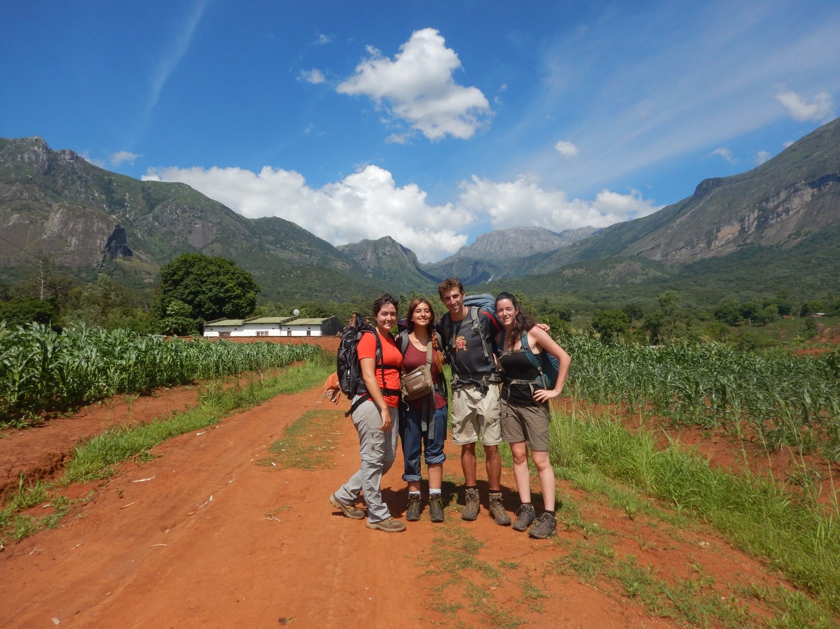
Hadas and I had already decided to do this trek even if it was just the two of us, but we were open to the option of joining or having other people join us so we'd have a bit of company on the mountain. We met Gal and Racheli in Nkhata Bay, and after some talking and planning, we set off on the long road south to the southern tip of Malawi. In Blantyre, which is the nearest big city to Mulanje, we stocked up on everything needed for the trip and headed toward Mulanje Town. On the way, the matatu we were riding in—which is a type of shared taxi—stopped in the middle of an uphill climb, the engine died, and the vehicle couldn't start—nothing too unusual in Africa, and as proof, not one of the locals even got up from their seat. I was sitting right behind the driver and was really surprised when the "conductor" (the guy responsible for the money in the matatu) jumped out in a second and pulled an extra battery from between my legs! I was shocked by their readiness for the event, and then he connected it in such a flimsy way that I would be very surprised to hear he doesn't get electrocuted at least twice a day. We continued on our way, and as we approached, we could already see Mulanje—from afar it looks like a kind of huge, massive boulder rising out of a completely flat area. Already from below you can see how bursting with water it is from the amount of waterfalls coming down from it. We arrived in Mulanje Town a bit late, but thanks to Dor, another friend who had just gone on the trek the day before and told the office we were coming, someone was waiting for us so we could make arrangements to leave the next day. In their office, called Mulanje Info, there is a relief model of the entire range, including where huts are located, and that's how they help you plan the trip. There are 7 different starting and ending points for the route, and 11 huts on the mountain, so you can really build whatever route you want. That's how we chose, together with the guide, a 4-day, 3-night route on the mountain starting the next morning directly from the office. A few last-minute purchases at the market, packing the backpacks, and off we go!
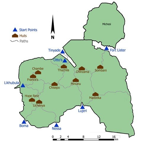
Map of all existing huts and starting points - will help you plan your route
The First Day
We arrived at the office after breakfast, where our guide and porter were already waiting for us. Even though it wasn't the usual season for climbing, we had nice weather and it was even hot at the beginning. From below, the task looked difficult and it wasn't easy to understand where the trail goes without having to climb a vertical wall. We set off and stopped often because the way really wasn't easy, and also because there were simply so many beautiful places to stop! We crossed the first stream, dipped our heads a bit, and drank from the clear water. At the next stop, we already set up a spread for lunch, again near a nice waterfall that cooled us down a bit from the grueling climb. From that long stop on, we felt like we were starting an even steeper climb than before. We didn't expect it and took it step by step. Overall, it's a climb of 1200 meters in about 5-6 hours! When you finish the climb, you reach the "plateau," which is a much gentler area, and you suddenly feel a sigh of relief after the ascent, enjoying a landscape that combines boulders and cliffs in an amazing way, feeling just like a scene from Lord of the Rings. We arrived at the hut around 5 PM, where the nice caretaker was waiting for us; he laid out mattresses and lit a fire for us. We did some stretching, cooked dinner, and fell into a much-needed sleep.
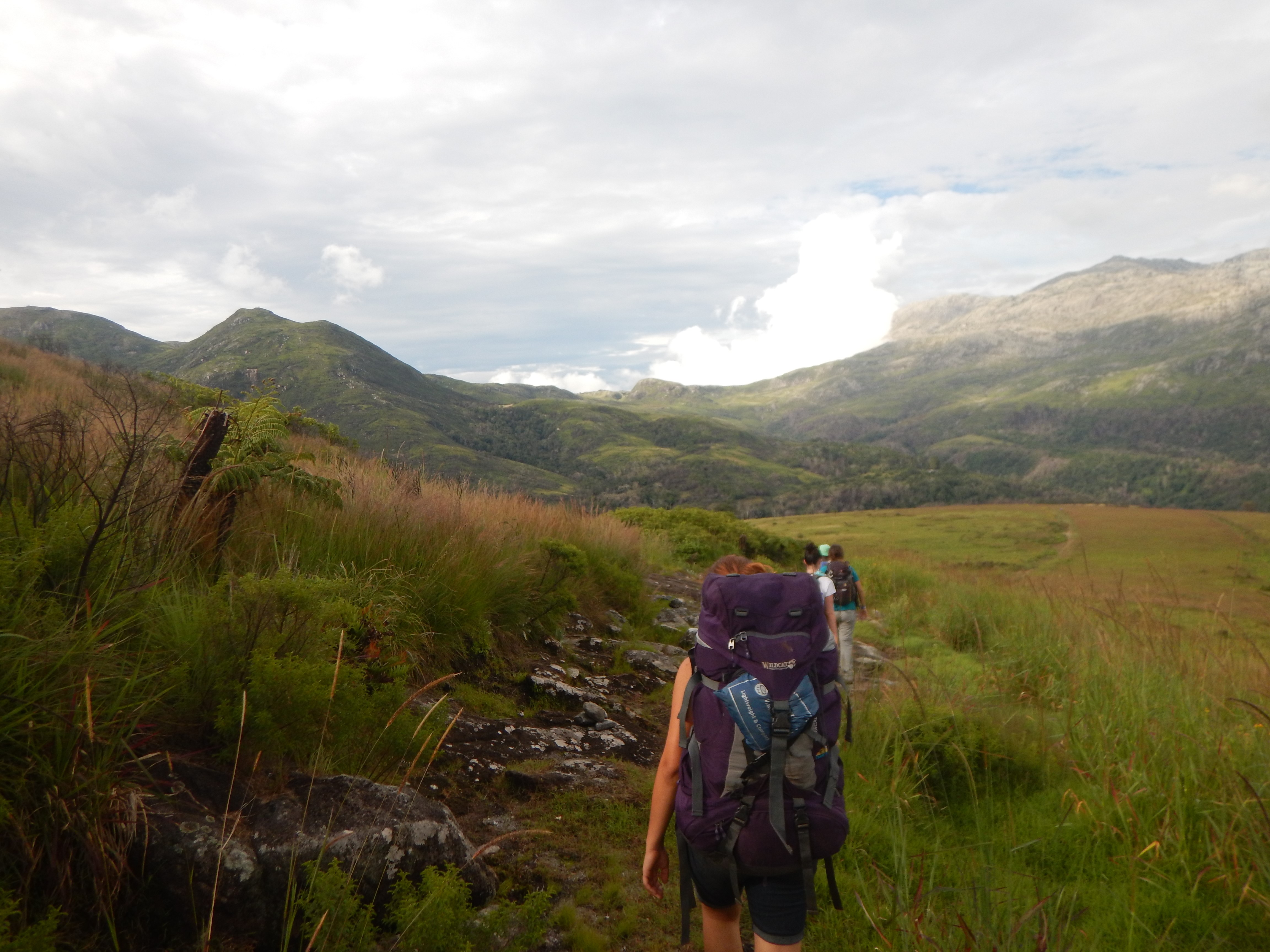
Up on the plateau
The Second Day
We started the second day with an excellent breakfast! We had saved cracked eggs in a half-liter bottle from yesterday and made omelets with onions and mushrooms on our camp stove. After the meal and a short pack-up, we set off for a day that initially looked sunny and nice. After about an hour, the sky began to turn murky and clouds seemed to attack us from below, covering the mountain. It affected visibility a bit and there was some drizzle, but nothing that made us stop walking, only making us appreciate the sun even more whenever it came out. In the middle of an uphill climb that was supposed to be the last one for that day, we suddenly spotted other hikers! The first ones we saw on the mountain. Of course, in weather like this, only Israelis are smart enough to do the trek, and as they got closer, we recognized that it was Dor, Nitzan, and Roni, who started the route a day before us. In the middle of the drizzle that slowly turned into rain, we sat together, opened a pineapple, and swapped stories, much to the dismay of the guides and porters who wanted to move on to a place with shelter. We said goodbye to them and continued as the rain started to intensify, turning the entire mountain into streams and rivers. When the rain stopped and the sky cleared a bit, we paused to digest the incredible landscape suddenly revealed around us. Water kept flowing all over the mountain, creating waterfalls and streams everywhere you looked, alongside cliffs from which you could see all the way down to the valley. Before arriving at Chisepo Hut, which is the hut at the foot of Sapitwa Peak, a surprise was waiting for us. We were getting very close to the hut and were just two minutes away when we suddenly found ourselves standing in front of a stream—relatively strong, flowing, with no way around it. The guide said this was the trail, and usually you walk carefully through a centimeter of water sliding over the rock, but now it was much more than a centimeter and with a strong current! We debated whether to wait a bit or press on, and in the end, we went for it. We took step after step carefully, helping each other and enjoying this accidental adventure that had suddenly landed on us. We all crossed safely and reached the hut, soaked but very pleased, and we all collapsed into an afternoon nap. Later we woke up to make dinner by the warm campfire and discuss the option we had for tomorrow: climbing to the summit of Mulanje in the morning and then continuing that day's scheduled trek. This option wasn't very appealing to us because it meant a tough 3-hour climb up and another 3-hour descent, after which we'd either sleep at the same hut another night (effectively adding a day to the trek) or continue that same day for another 3 hours to the next hut. We decided to skip the summit, which made the next day relatively short and easy.
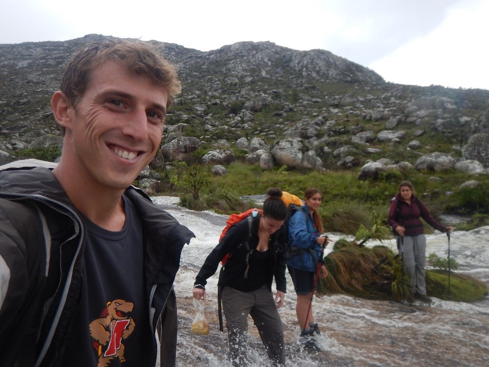
Crossing the river
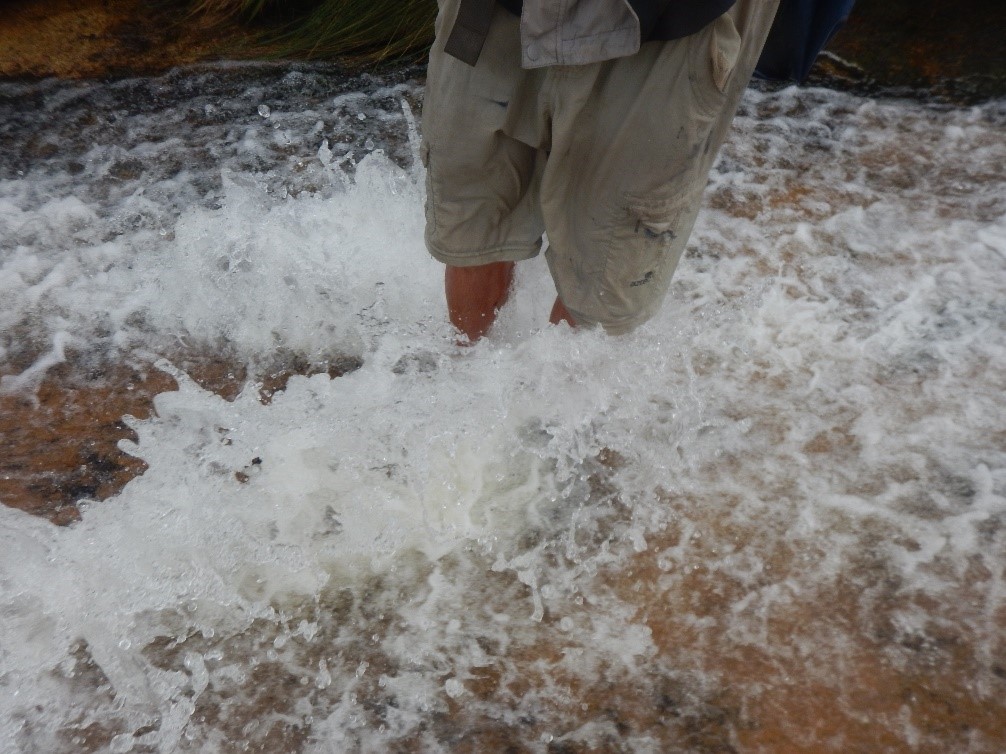
Very strong knee-high current and slippery rocks!
The Third Day
The decision to skip the summit on the second day gave us a late wake-up and a slow morning on the third day. We prepared porridge and tea and savored the incredible view from the hut! We prepared ourselves mentally for re-crossing yesterday's daunting river, setting off all wearing Source sandals with shoes in hand. Upon reaching the stream, we felt almost as if it was laughing at us—a very weak stream that barely wet the stones we walked on. The rest of the day was somewhat cloudy with relatively easy ups and downs. Midway through, breathtaking views of different areas opened up before us each time. After 4 hours of easy walking with plenty of breaks, we reached Chambe Hut. We arrived in the afternoon and enjoyed a bit of sunshine swimming in the stream right next to the hut. Chambe is the most accessible hut on the mountain from below, via a trail called Skyline Path. After the only people we had seen on the mountain were our Israeli friends, people suddenly started arriving at the hut in full groups. We realized that going up there is a weekend attraction among locals. There were volunteer doctors working at Blantyre Hospital, a couple of travelers, and another couple working in the area. Toward evening a family even arrived, and they moved to a nearby hut in the area. In the evening it was lively at the hut; we prepared food and tasted a bit of what each of the other groups made.
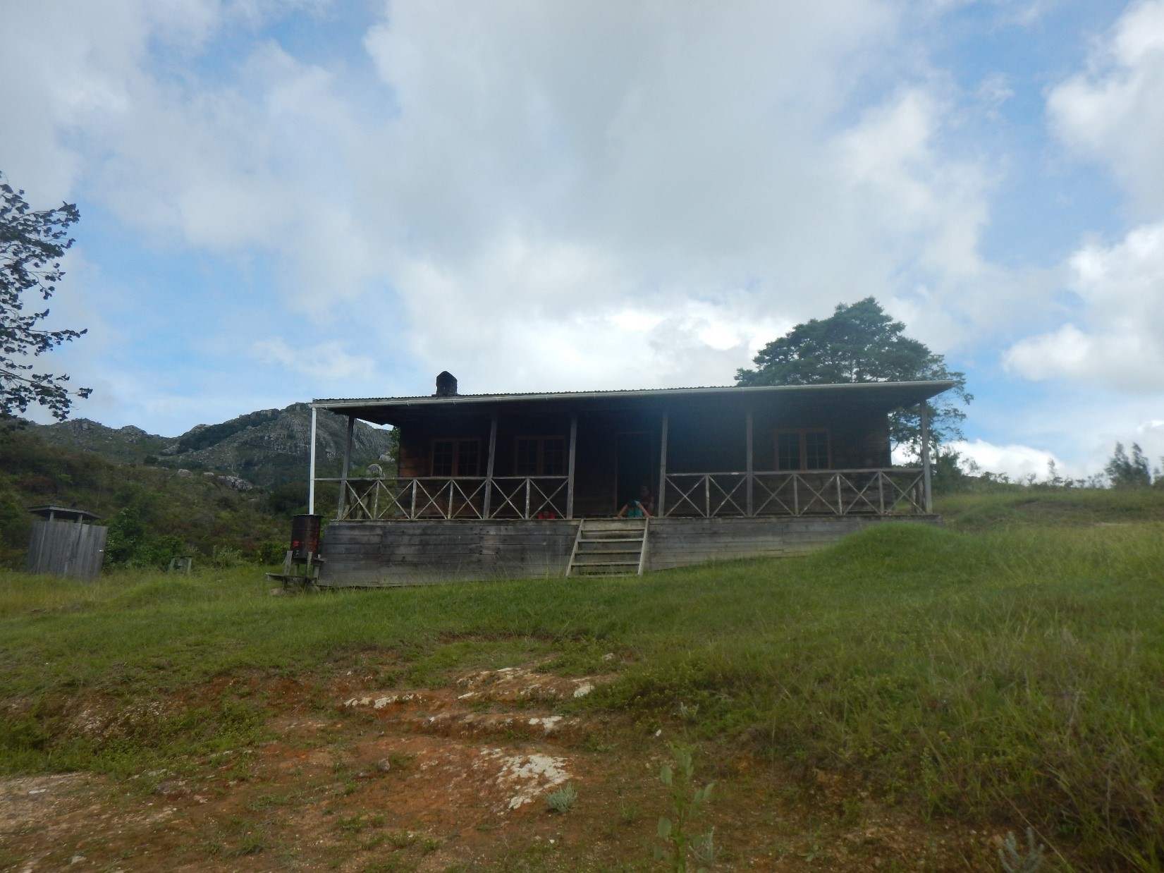
The popular Chambe Hut
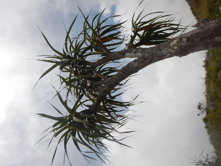
Interesting vegetation up top
The Fourth Day
We started the last day on tiptoes, with all the other groups in the hut sleeping and only us waking up early and setting off. We set out on the beautiful Skyline Path, which also provided amazing views while we were right at cloud level. From there, a long, steep descent that was fortunately accompanied by great weather.
The highlight came in the middle of the day, when we reached a gorgeous waterfall that creates a deep, clean pool. We jumped right into the water without thinking twice, and it was the most refreshing thing in the world! When you get close to the waterfall, the current is so strong that it's like swimming in an endless pool—you swim fast with all your strength and stay in place! Afterwards, some Indians and Pakistanis arrived who were a bit strange and took selfies with us one by one before even introducing themselves..
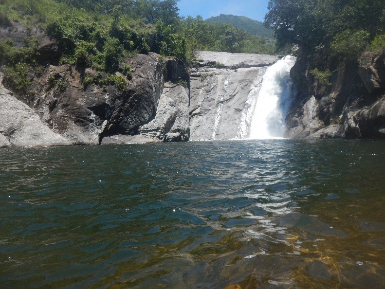
The waterfall and the clear pool
So after a long break at the waterfall and lovely pool, we finished the rest of the descent down and turned around proudly to look at the mountain we had conquered.